According to Wikipedia in April, 2026: Wake Island is claimed by the Marshall Islands but is administered by the United States as an unorganized and unincorporated territory and is part of the United States Minor Outlying Islands. The island is administered by the Department of the Interior and managed by the United States Air Force. While there are no permanent residents, approximately 300 people are on the island at any given time, primarily military personnel and contractors.
Scroll to the bottom of this page to see the full Wikipedia article.
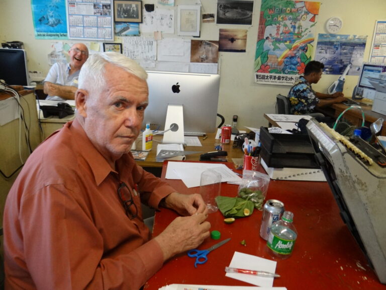
Posted in December, 2016, in Majuro.
As a number of Asian nations on the Pacific Rim beef up their military prowess, it is expected that the US will, in the next few years, begin upgrading its facilities at the strategic Wake Island (a.k.a Enen Kio), which is 1,501 miles east of Guam, 2,298 miles west of Honolulu, Hawaii and just 780 miles from Majuro, capital of the Marshall Islands.
Now a US military base, the US has laid claim to the atoll since 1898, but the Marshall Islands government insists the atoll lies within its borders. This ‘ownership’ was reaffirmed in May, 2016, when the RMI submitted a 450-page document to the United Nations outlining what it considers to be its geographical coordinates, which included the atoll that is locally known as Enen Kio (or Eneen Kio, meaning Island of the Kio Flower’.
After submitting the document, the then US Ambassador to the Marshalls, Tom Armbruster, said: “The State Department is aware of the RMI’s UN filing and is in the preliminary stages of getting technical experts together from both countries to discuss the maritime boundary.”
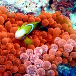
In one of a number of articles on the atoll, Micronesian history expert Dr. Dirk Spennemann states: “Oral traditions claim that the Marshallese knew of Wake Atoll prior to contact with European navigators … Prized were the wing bones of albatross, from which tattooing chisels could be made. In addition, the rare kio flower grew on the atoll. Bringing these items to the home atolls implied that the navigators had been able to complete the feat of finding the atoll using traditional navigation skills of stars, wave patterns and other ocean markers.”
Wake and World War II
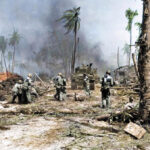
The atoll is best known for its role in World War II: On December 11, 1941, Wake Island was the site of Japan’s first unsuccessful attack on American forces during World War II when Marines, Naval personnel, and civilians on the island repelled an attempted Japanese invasion, sinking two destroyers and a transport. The island then fell to Japanese forces 12 days later, after a successful second invasion attempt on December 23, 1941, this time with extensive support from Japanese carrier-based aircraft returning from the attack on Pearl Harbor. Wake Island remained occupied by Japanese forces until the end of the war and was surrendered back to US forces on September 4, 1945.
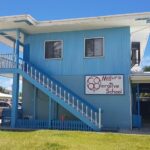
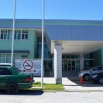
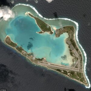
Today, the atoll is a US Air Force base and, on an almost daily basis, is used as a fueling stop for military planes. It has a small band of Air Force staff, led by Commander, Captain Allen Jaime, while the Site Manager is Michael Marrero who works for contractors Chugach Federal Solutions and leads a team of skilled staff, including a large number of Thai workers.
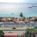
The top brass live in houses near the main village, while the rest of the Americans and Thais live in the various apartment blocks, while lagoon-side make-shift cottages, built by the Thais, serve as on-island weekend retreats. The island’s facilities include a reverse osmosis water plant, a couple of medics, one store that opens for just an hour day, a cafeteria, a bank, and the Drifters Reef Bar (cash only, please), and the island’s most important feature: One of the Pacific’s longest runways (nearly 10,000 feet), which greatly adds to its strategic value.
Bringing Wind Ryder Home
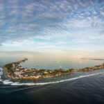
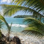
In the first half hour spent on Enen Kio Atoll (a.k.a. Wake Island) you feel something’s not quite right. Is it just that you’re standing on one of the world’s most remote dots of land? Is it the unusual sight of military folk wandering about in their camouflage outfits? And then it dawns on you: Palm trees. Where are the palm trees?
In their place are thousands of tall, dark green ironwood trees busily shedding their pine needles and making quite the statement as they stand on parade alongside the island’s runway and roads.
“Welcome to Wake Island,” a gentleman tells the crowd of a dozen or so newcomers in the airport terminal and then continues on down a list of dos and don’ts (many more of the latter) while on the Air Force base. Also comes news of the island’s largest population: Rats.
“Rats! Oh, no, that’s all we need…” Cary Evarts, my husband, muttered. “Rats on the boat chewing everything up.”
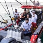
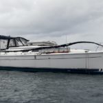
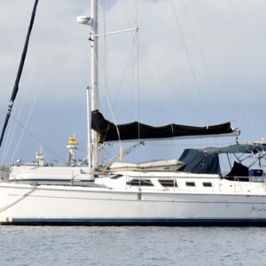
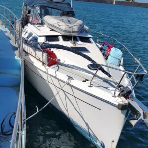
The boat in question is the 41-foot yacht Wind Ryder, which on the evening of July 7 (2016) was dismasted on its way from Majuro to Honolulu, Hawaii. Fortunately, the crew, Don Moore and his mother Judy, were able to cut the mast, its boom, and the rigging off and release it to the deep. They waited until the morning to check for damage, but fortunately realized the boat had come out of the ordeal unscathed except for a couple of small scrapes and a ding in the dodger.
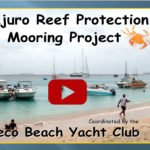
After checking in with the Mieco Beach Yacht Club daily HF radio net and explaining their plight, they started the engine and changed course for the closest piece of land: Wake. Permission was sought, and granted, to enter the atoll, but on arriving safely, they realized re-rigging the boat in this remote location would be impossible. Neither felt comfortable about going onwards on the yacht without a mast, so after some discussion, the pair were allowed to leave the island.
Part of that discussion was the guaranteed removal of the yacht from the island, which is an official wildlife reserve. Back in Majuro, Cary decided he would take on that task.
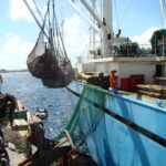
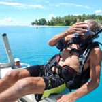
And so it was, after months of organization that involved officials at Majuro’s US Embassy, Chugach Federal Solutions in Alaska, the US Air Force, and the Defense Logistics Agency, that Cary and I flew in to Wake on a military charter flight to bring the boat back to Majuro.
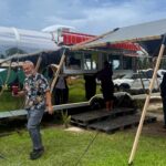
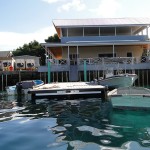
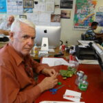
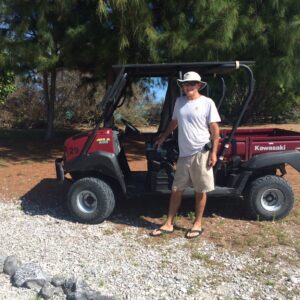
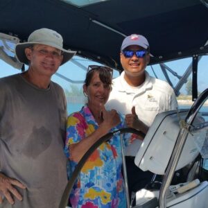
The island’s Site Manager, Michael Marrero, greeted us and handed over the keys to a rugged little vehicle called a Mule. It was quite the necessity as Wind Ryder had been safely tied up and looked after by Michael’s team at the island’s marina, a 30-minute drive from ‘town’.
We arrived at the yacht and, phew, no rats to be seen. But there was a fridge full of extremely old and smelly food and a long list of other items that needing dealing with.
Michael kindly allowed us to use his computer to check the forecast, which happily appeared to be a great weather window for the 780-mile voyage that would see us winding our way down through the atolls of the Marshalls to Majuro.
And so, over the next three days, we worked hard to get the boat in shape, helped by the many officers and staff who came to visit us and offer assistance.
We purchased fuel, an extremely precious commodity in such an out-of-the-way location, and food from the dining hall.
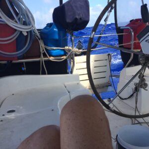
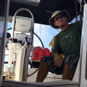
And all of a sudden it was time to go; to turn on the 50-horsepower diesel engine and head out the pass.
Meltdown. I was hit by a hysteria attack … a breathless, ghastly few minutes with me staring at the disappearing shore and thinking “What are we doing on a sailboat without a mast?”
Silly me. If there is anyone you would want to do a voyage like this with, it would be Cary: Mechanic, electrician, plumber, and sailor.
He estimated that the best possible scenario would be that Wind Ryder would take six days to reach Majuro. He was wrong: It took six and a half.
We had two rain squalls on deck and otherwise beautifully sunny skies and moon-filled nights. And despite not having a mast, the boat rode the waves extremely well.
A couple of nights out, Cary came up the companionway and said to me quietly. “Now, sweetie, I’m going to have to turn off the motor. Something’s got stuck in the fuel intake. But it’ll be fine.”
“No problem,” I said confidently. There was no need for a meltdown. We were on our way home.