Menu

The

Guide

Kili Island

A ceremonial moment on Kili.
FACT FILE

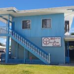
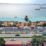
Population: 415 (226 males, 189 females). Land Area: 0.36 square miles. Yacht permit fee: $25, but need to get permission from Bikini Atoll Local Government in Uliga (note, however, that it’s an unlikely yacht destination). Mayor: Tommy Irujiman Jibok Member of Parliament: Jess Gasper Jr.

Since 1948, Kili Island has been home to many of the families of displaced people from Bikini Atoll. In recent years, the island has seen increased flooding and an airstrip that is often awash or muddy. As a result, in August 2015, the Kili/Bikini/Ejit Council requested assistance from the US government with relocation of the population. Follows is an interview with former Bikini Liaison Officer Jack Niedenthal by Radio New Zealand on climate change as it pertains to Kili. You can read or listen to the transcript of the August 2015 interview below. (Editor’s note: Despite the headline below, as of 2025, people of Bikini are still living on Kili.)

Bikini islanders homeless again

“It’s getting to the point where people are tired of having water in their living rooms and trying to deal with the waves and the water coming over the island.”

LEAD-IN TO THE RADIO NEW ZEALAND INTERVIEW: “The Bikini Island community in the Marshall Islands, displaced by nuclear testing seventy years ago is now appealing to the United States for help to find a new home. Their home for many years has been Kili Island which is being affected by sea level rise, repeated king tide flooding and storm surges. The former Trust Liaison Officer for the people of Bikini, Jack Niedenthal (he resigned in June 2016), told Jenny Meyer the US moved the community several times in the 1940s to inhospitable islands until they settled on Kili Island which he says is now like the canary in the climate change coal mine.”

Jack Niedenthal

JACK NIEDENTHAL: Finally they decided on Kili because the people of Bikini really wanted their political freedom, they didn’t want to live on anyone else’s land. Kili was public land. So they were moved there in 1948. And that’s where they’ve pretty much been since the US began testing nuclear weapons in the Marshall Islands, a total of 67 weapons but 23 of them were on Bikini and 20 of those weapons were hydrogen bombs, so they haven’t been able to go back.

JENNY MEYER: So what’s happening now? I understand that Kili now, has become even more vulnerable and less inhabitable because of the effects of climate change. And there’s a request or an appeal to the US Government to actually help try and find a safer home for these people who have been displaced?

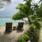
JN: You have to understand that Kili Island is a single island. It’s not an atoll like most of the places here where people live. So for six months of the year you can’t fish. The Bikinians have always considered Kili like a prison. And what’s happened over the last four years, some people look at some of the pictures from Kili and think that this is a one-time event. Well, it’s happened every year since 2011, the island has been inundated by waves, and not just a little bit. I mean there’s pictures of them wading through water on roads in the middle of their island. And this year they became very concerned because in the previous years it was only during the king tides in February and March when there’s one big tide every year. This year it happened in January and February and there was a storm recently that also blew water up onto the island. So it’s getting to the point where people are tired of having water in their living rooms and trying to deal with the waves and the water coming over the island. It broke the sea wall this time. So what they’ve done is they’ve passed two resolutions. One resolution is what we’re calling Plan B that will enable us to use our resettlement trust fund that was given to us, US$90million in the early ’90s which was basically to take care of people where they are now and try to try to do some clean up on Bikini. We want to be able to use that outside of the Marshall Islands because right now we can’t. And the second resolution which is even more important is, we really believe that US should pay for any kind of movement of the people of Bikini from Kili because they were the ones that put them there. The Bikinians didn’t move there on their own. They were put there by the US Government. And now they feel that they shouldn’t have to pay for this out of their very valuable trust funds which they use to survive on from day to day. They would like the US to come in and help them financially and also figure out where to go. We don’t feel like it’s up to us to figure this out. The US has to come in and since they made these promises to Bikinians many years ago that they would be like the ‘Children of America’, the Bikinians just want them to live up to their promise and help them.

JM: So, essentially, they’re not only nuclear refugees, they’re climate refugees? So what are the options in terms of where they could go? Is there somewhere else in the Marshall Islands group? Or are they looking to go to America? And can you just say how many people we’re talking about here?

JN: Well, there’s about 600 to 700 people on Kili right now. And we had three hearings. We had one hearing on Majuro where there’s many Bikinians. And we had one hearing on Ejit Island in Majuro Atoll which is exclusively people of Bikini. And then last Friday we went down to Kili Island and had a hearing there to explain to people what we’re trying to do here. It’s very depressing. Because even though Kili is not a great place but still it’s been home to these people for 70 years. And any time people have to move on mass from a place, it’s a horrible thing to even think about. You know we already have communities in the US, in Arkansas and in Oregon and places like that. Some people are talking about maybe figuring out a way to move some people there. Other people have talked about places here in the Marshall  Islands. But the very tricky part about that is, if you moved somewhere here in the Marshall Islands, you’re going to be living on someone else’s land. And that takes away a lot of your political freedom. I don’t know exactly if that’s an option. But we just want the US to help us look into this. We feel like it’s their problem.

Social Share

Subscribe to the Marshall Islands Journal online edition for $57 per year.
Learn more.

The Marshall Islands Journal

The Marshall Islands Division of Immigration

Sailing Marshall Islands

Office of the President

Featured Posts

Expert weaver Susan Jieta makes a mat. Photo: Karen Earnshaw.

Susan Makes a Mat

Expert weaver Susan Jieta very kindly made a ‘jainai’ (fresh coconut frond mat) and allowed me to photograph the steps she took to create this natural fiber mat that can be used for sitting on for using as a place to store goods.

MIMRA Annual Reports

The Marshall Islands Marine Resources Authority (MIMRA) is the fisheries agency of the Republic of the Marshall Islands. Each year MIMRA publishes its annual report which covers all aspects of the government organization for that Financial Year.

National Anthem

Making a video of youth singing the Marshallese National Anthem was a long-held dream … It became a reality thanks

The first race of the Mieco Beach Yacht Club. From left are Roxanne, Kaimana, and Seal. Photo: Grant James

Mieco Beach Yacht Club

The Mieco Beach Yacht Club is designed to be a social and informational group for cruisers and like-minded people ashore.

Comments

Give us your thoughts or ask Karen a question.

Menu

Featured Posts

MIMRA Annual Reports

The Marshall Islands Marine Resources Authority (MIMRA) is the fisheries agency of the Republic of

Country Information

Climate: The year-round average daily temperature is 80.4 degrees Fahrenheit. While generally hot, cooling northeast

Beautiful aerial shot of Majuro Atoll. Photo: Jamison Logan.

Yellow Pages

This is the nuts and bolts guide to finding things in Majuro and being able

Airport Info

After flying into Amata Kabua International Airport you have a number of transport options to

The front entrance to Majuro Hospital in Delap, next to the Capital Building.

Health Insurance

The Supplemental Health Plan — Insurance for Off-Island Care The Marshall Islands offers a national

Featured Posts

Beautiful aerial shot of Majuro Atoll. Photo: Jamison Logan.

Yellow Pages

This is the nuts and bolts guide to finding things in Majuro and being able

Food Truck 692

If you’re in need of a quick and tasty lunch, try The Food Truck 692

Bikendrik Island

Bikendrik Islands is one of two luxurious places to stay on a small islands in

Toeak Bar

Good food with a fabulous view: That’s The Toeak Bar and Grill in Uliga. The

Enemanet Island

Enemanet Island, a few miles from downtown Uliga in Majuro, is the perfect place for

RRE Hotel

The Hotel Robert Reimers has a traditional Marshallese flavor, primarily due to its luxurious tropical

Featured Posts

Expert weaver Susan Jieta makes a mat. Photo: Karen Earnshaw.

Susan Makes a Mat

Expert weaver Susan Jieta very kindly made a ‘jainai’ (fresh coconut frond mat) and allowed

National Anthem

Making a video of youth singing the Marshallese National Anthem was a long-held dream …

Natalie Nimmer

Today’s guest is NATALIE NIMMER who has lived in the RMI off an on since

The RMI Riddle

The RMI Riddle is published each week.. It is also published in The Marshall Islands

Featured Posts

Marshalls Billfish Club

The Marshalls Billfish Club hosts regular monthly tournaments and two premier competitions each year: The July Tournament and the All Micronesia Tournament, a.k.a. the All Mike.

Diving

Despite the fact that Majuro is the country’s largest population center, with about 35,000 residents,

Dive Permit

  The Historic Preservation Office, found in the Alele Museum and Library building next to

MIMRA

The Marshall Islands Marine Resources Authority (MIMRA) is the fisheries agency of the Republic of the Marshall Islands. It looks after all aspects of commercial fishing in the nation, bringing in substantial revenue. Director Glen Joseph believes in transparency at all levels, commissioning in-depth, magazine-style annual reports every year.

Moona Kitesurfs @ Beran

Beran Island in Ailinglaplap is the capital of surfing in the Marshall Islands. It’s managed by Indies Trader, a company owned by Australian Martin Daly.

Reef researcher Sara Cannon and Cary Evarts with a huge tuna.

Researching our Reefs

Marine scientists are regular visitors to the Marshall Islands. Their specific research topics vary, but most choose the Marshalls because our reefs are so accessible … plus those that aren’t so accessible, on the remote outer islands, are truly unique.

Featured Posts

Candice Guavis with one of the Enemanet mooring buoys. Photo: Karen Earnshaw

Mooring Project

The Mieco Beach Yacht Club began working on a mooring project for Enemanet and Eneko

Enemanet Island

Enemanet Island, a few miles from downtown Uliga in Majuro, is the perfect place for

Checking in to Majuro

Yachts checking into Majuro, capital of the Marshall Islands, generally agree that the process is

Menu

Featured Posts

MIMRA Annual Reports

The Marshall Islands Marine Resources Authority (MIMRA) is the fisheries agency of the Republic of

Country Information

Climate: The year-round average daily temperature is 80.4 degrees Fahrenheit. While generally hot, cooling northeast

Beautiful aerial shot of Majuro Atoll. Photo: Jamison Logan.

Yellow Pages

This is the nuts and bolts guide to finding things in Majuro and being able