Menu

The

Guide

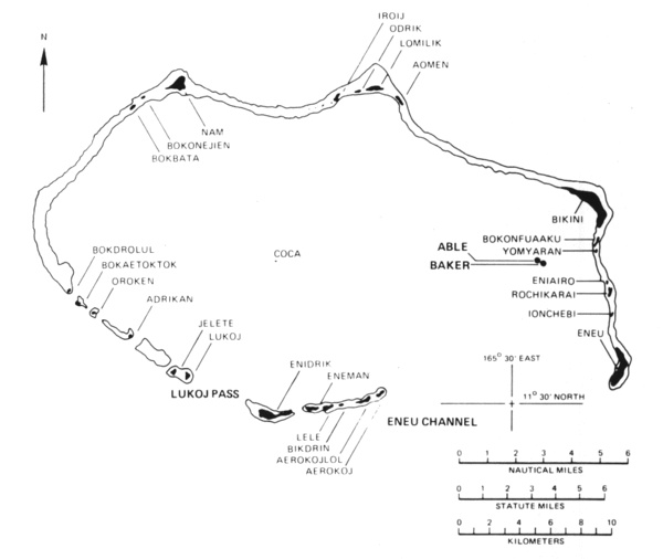
Bikini Atoll

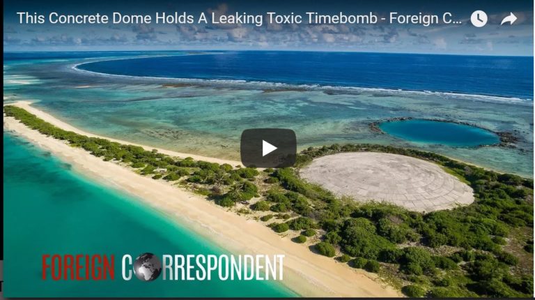
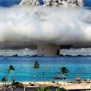
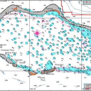
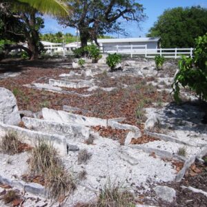
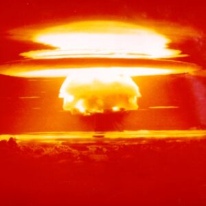
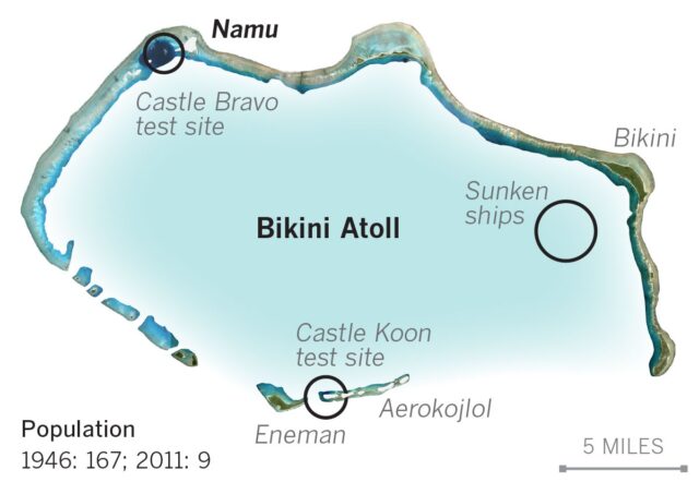
Bikini Atoll, in the northern Marshall Islands, entered world history in 1946 when the United States asked its 167 residents to leave “temporarily” so the atoll could be used to test atomic weapons. Between 1946 and 1958, the U.S. detonated 23 nuclear devices at Bikini — including the 1954 Castle Bravo test, the largest ever exploded by the United States. The Bikinians were moved first to Rongerik, then Kwajalein, and finally to Kili Island, beginning decades of displacement, hardship, and unresolved efforts to safely return home.

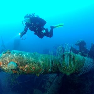
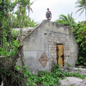
The nuclear tests left the atoll’s lagoon littered with sunken warships — targets from Operation Crossroads in 1946, including the aircraft carrier USS Saratoga and the Japanese battleship Nagato. From 1996 to 2008, the Bikini Atoll Council opened the lagoon to divers, and Bikini became a world-renowned wreck-diving destination, drawing roughly 2,500 divers to explore its “ghost fleet” before rising fuel costs and airline troubles forced the operation to close.

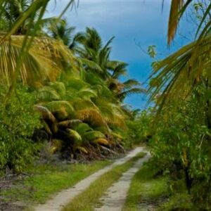
Today Bikini remains uninhabited. Radiation levels, while much reduced, still exceed what most resettlement plans consider safe, and the Bikinian people continue to live in exile — most in Kili, Ejit, and the United States.

FACT FILE

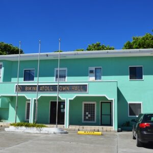
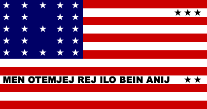
Number of Islets: 23. Population: A small number of maintenance workers, usually less than 10. Land Area: 3.4 square miles. Lagoon Area: 229.40 square miles. Yacht permit fee: Need to get permission from Bikini Atoll Local Government. Phone: (692) 625-3177. Mayor: Tommy Irujiman Jibok Nitijela Member: Jess Gasper Jr. (For details about the flag, see below.)
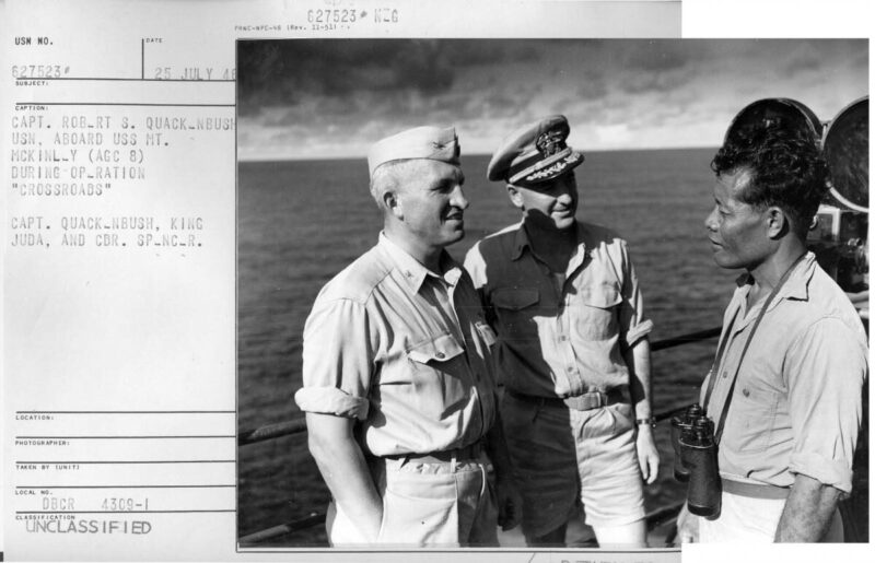
Pictured: Captain Robert S. Quakenbush (left), King Juda (right) and Commodore Spencer (center) aboard the USS Mt. McKinley the morning of Baker Day, July 25, 1946.

Bikini King Juda for quote png

We will go believing that everything is in the hands of God.

— King Juda, the leader of the Bikini people

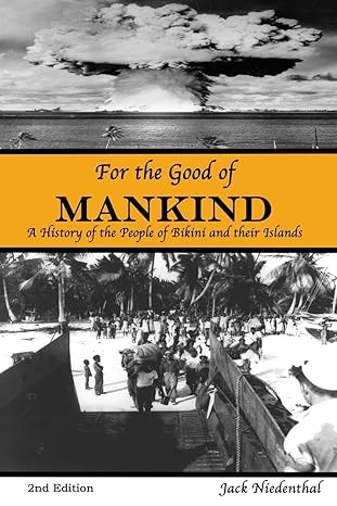
Cover of For the Good of Mankind: A History of the People of Bikini and their Islands by Jack Niedenthal

Book Corner

For the Good of Mankind: A History of the People of Bikini and Their Islands — Jack Niedenthal (2nd Edition)

Bikini Atoll was the site of a series of 23 nuclear detonations by the United States between 1946 and 1958. Former Bikini Liaison Officer Jack Niedenthal's history of that era draws heavily on oral testimony from the Bikinians themselves — beginning with the Sunday in February 1946 when Commodore Ben H. Wyatt asked the islanders to leave their atoll temporarily "for the good of mankind and to end all world wars," and King Juda answered, "We will go believing that everything is in the hands of God." The book follows the Bikinians from that first removal ahead of Operation Crossroads through decades of displacement — their struggle to make sense of the science reshaping their islands, alongside the day-to-day work of finding food, raising families, and holding onto their culture amid forces of the Cold War largely outside their control.

In their own words

"I thoroughly enjoyed the book, particularly reading the history of Bikini in the words of the people. The book assures that these traditional stories will be available for others to read, but perhaps most importantly, for younger generations of islanders."— Allen P. Stayman, U.S. Compact of Free Association Negotiator, 1999–2001

"A compelling account of the troubled history of the people of Bikini Atoll. Niedenthal's skillful use of oral history enables the Bikinians to tell much of their own story… a welcome and useful contribution to Pacific Islands studies."— Robert C. Kiste, Director, Center for Pacific Islands Studies, University of Hawai‘i

Find it on Amazon, or search for more editions and sellers here.
The above brochure was produced by Lust4Rust & Aquatic Adventures, which you can check out by going to Bikini Atoll | Pete Mesley Dive Excursions 

THE FLAG OF THE PEOPLE OF BIKINI ATOLL

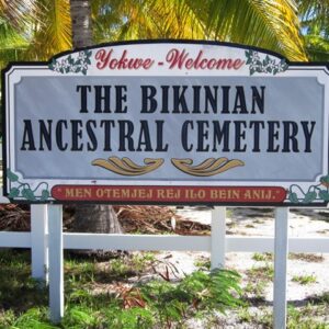
The 23 white stars in the field of blue in the upper left hand corner of the flag represent the islands of Bikini Atoll. The three black stars in the upper right of the flag represent the three islands that were vaporized by the March 1, 1954, 15 megaton hydrogen bomb blast, code named Bravo. The two black stars in the lower right hand corner represent where the Bikinians live now, Kili Island, 425 miles to the south of Bikini Atoll, and Ejit Island of Majuro Atoll. These two stars are symbolically far away from Bikini's stars on the flag as the islands are in real life (both in distance and quality of life). The Marshallese words running across the bottom of the flag, "MEN OTEMJEJ REJ ILO BEIN ANIJ" [Translation: "Everything is in the hands of God."], represent the words spoken in 1946 by the Bikinian leader, Juda, to U.S. Commodore Ben Wyatt when the American went to Bikini to ask the islanders--on a Sunday after church--to give up their islands for the 'good of all mankind' so that the U.S. could test nuclear weapons. The close resemblance of the Bikinian's flag to the flag of the United States is to remind the people and the government of America that a great debt is still owed by them to the people of Bikini.
BIKINIAN ANTHEM

No longer can I stay; it’s true.
No longer can I live in peace and harmony.
No longer can I rest on my sleeping mat and pillow
Because of my island and the life I once knew there.

The thought is overwhelming
Rendering me helpless and in great despair.

My spirit leaves, drifting around and far away
Where it becomes caught in a current of immense power –
And only then do I find tranquility.

Written in 1946 by Lore Kessibuki (1914-1994)
To dive Bikini Atoll you must contact Bikini Local Government for information on current visitation options and regulations: bikinijack@gmail.com 

Description of your photo

Return to Bikini Atoll

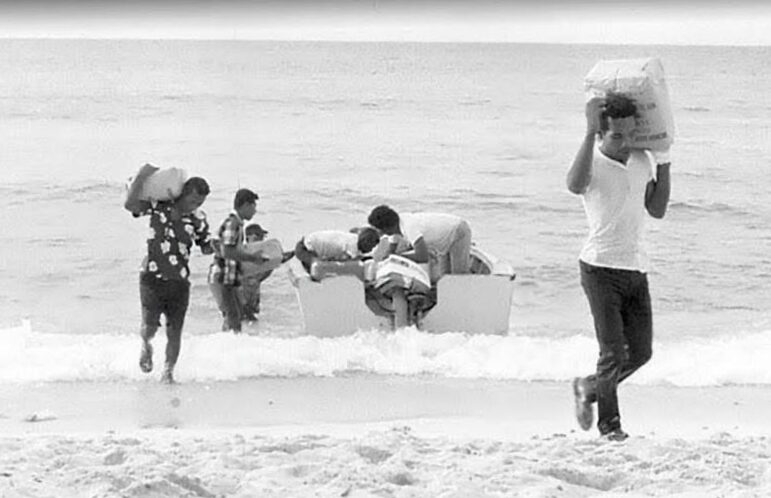
In 1973, three extended families and workers returned to Bikini Atoll to rebuild, believing it was safe after a declaration by the U.S. Atomic Energy Commission in the 1960s. However, by 1975, monitoring revealed high radiation levels in their bodies, leading to their evacuation in 1978 and the conclusion that the atoll was uninhabitable." From the RiMajolOnline archive

Social Share

Subscribe to the Marshall Islands Journal online edition for $57 per year.
Learn more.

The Marshall Islands Journal

The Marshall Islands Division of Immigration

Sailing Marshall Islands

Office of the President

Featured Posts

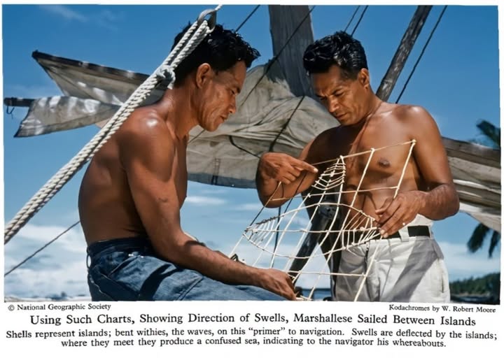
Stick Charts

Photo: W. Robert Moore, National Geographic Society Historically, Marshallese are considered among the best navigators in the Pacific. They had

The Final Years of Majuro

This is one of the great films about the Marshall Islands’ past, present and future. Created by a handful of young, inspired filmmakers, it gives a level of insight rarely achieved. — Karen Earnshaw

Breadfruit and Bwiro

Bwiro: Breadfruit Leaves vs. Tinfoil Preserved breadfruit cooked the island way, in double breadfruit leaves tied with coconut-frond string, alongside

Riwut Racing

Riwut canoes are miniature canoes that zip along at incredibly high speeds. The racing of these tender vessels seems to

Comments

Give us your thoughts or ask Karen a question.

Menu

Featured Posts

Nauru Airlines

A Nauru Airlines plane in a hangar in Brisbane, Australia. Nauru Airlines serves Majuro twice

The RMI Presidents

The first President of the Marshall Islands was Amata Kabua, who served from 1979 to

Airport Info

After flying into Amata Kabua International Airport you have a number of transport options to

Country Information

Climate: The year-round average daily temperature is 80.4 degrees Fahrenheit. While generally hot, cooling northeast

MIMRA Annual Reports

The Marshall Islands Marine Resources Authority (MIMRA) is the fisheries agency of the Republic of

Beautiful aerial shot of Majuro Atoll. Photo: Jamison Logan.

Yellow Pages

This is the nuts and bolts guide to finding things in Majuro and being able

Featured Posts

Food Truck 692

If you’re in need of a quick and tasty lunch, try The Food Truck 692

Restrooms Review

Not all restrooms are created equal in Majuro, so here’s a rundown on where to

Handicrafts

The Marshall Islands handicrafts are extremely artistic, long-lasting and a joy to own. The making

Toeak Bar

Good food with a fabulous view: That’s The Toeak Bar and Grill in Uliga. The

Bikendrik Island

Bikendrik Islands is one of two luxurious places to stay on a small islands in

Beautiful aerial shot of Majuro Atoll. Photo: Jamison Logan.

Yellow Pages

This is the nuts and bolts guide to finding things in Majuro and being able

Cruisers enjoy a meal at Won Hai Shien. Photo: Karen Earnshaw

Won Hai Shien

A group of cruisers were lucky enough to have Won Hai Shien owner give us

Featured Posts

Riwut Racing

Riwut canoes are miniature canoes that zip along at incredibly high speeds. The racing of

Natalie Nimmer

My Remembering RMI guest is NATALIE NIMMER who has lived in the RMI off and

National Anthem

Making a video of youth singing the Marshallese National Anthem was a long-held dream …

Handicrafts

The Marshall Islands handicrafts are extremely artistic, long-lasting and a joy to own. The making

Featured Posts

Marshalls Billfish Club

The Marshalls Billfish Club hosts regular monthly tournaments and two premier competitions each year: The July Tournament and the All Micronesia Tournament, a.k.a. the All Mike.

Diving

Despite the fact that Majuro is the country’s largest population center, with about 35,000 residents,

Dive Permit

  The Historic Preservation Office, found in the Alele Museum and Library building next to

MIMRA

The Marshall Islands Marine Resources Authority (MIMRA) is the fisheries agency of the Republic of the Marshall Islands. It looks after all aspects of commercial fishing in the nation, bringing in substantial revenue. Director Glen Joseph believes in transparency at all levels, commissioning in-depth, magazine-style annual reports every year.

Moona Kitesurfs @ Beran

Beran Island in Ailinglaplap is the capital of surfing in the Marshall Islands. It’s managed by Indies Trader, a company owned by Australian Martin Daly.

Reef researcher Sara Cannon and Cary Evarts with a huge tuna.

Researching our Reefs

Marine scientists are regular visitors to the Marshall Islands. Their specific research topics vary, but most choose the Marshalls because our reefs are so accessible … plus those that aren’t so accessible, on the remote outer islands, are truly unique.

Featured Posts

Candice Guavis with one of the Enemanet mooring buoys. Photo: Karen Earnshaw

Mooring Project

The Mieco Beach Yacht Club began working on a mooring project for Enemanet and Eneko

Enemanet Island

Enemanet Island, a few miles from downtown Uliga in Majuro, is the perfect place for

Checking in to Majuro

Yachts checking into Majuro, capital of the Marshall Islands, generally agree that the process is

Menu

Featured Posts

Nauru Airlines

A Nauru Airlines plane in a hangar in Brisbane, Australia. Nauru Airlines serves Majuro twice

The RMI Presidents

The first President of the Marshall Islands was Amata Kabua, who served from 1979 to

Airport Info

After flying into Amata Kabua International Airport you have a number of transport options to

Country Information

Climate: The year-round average daily temperature is 80.4 degrees Fahrenheit. While generally hot, cooling northeast

Featured Posts

Nauru Airlines

A Nauru Airlines plane in a hangar in Brisbane, Australia. Nauru Airlines serves Majuro twice

The RMI Presidents

The first President of the Marshall Islands was Amata Kabua, who served from 1979 to

Airport Info

After flying into Amata Kabua International Airport you have a number of transport options to

Country Information

Climate: The year-round average daily temperature is 80.4 degrees Fahrenheit. While generally hot, cooling northeast